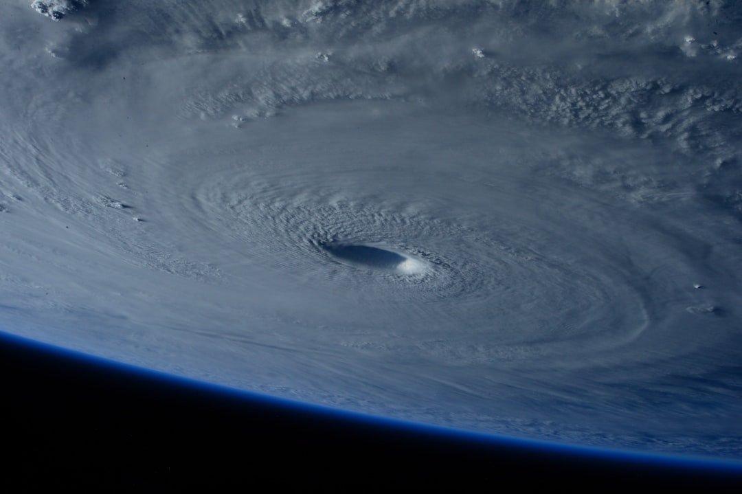
The Invisible Cameras Monitoring Earth’s Most Violent Storms
When a devastating hurricane emerges and begins its relentless march across the Atlantic Ocean, the most reliable and comprehensive imagery capturing its development originates from an extraordinary vantage point: a sophisticated instrument stationed approximately 22,236 miles above Earth’s equatorial plane. This remarkable device, known as the Advanced Baseline Imager, serves as the core sensing technology aboard NOAA’s GOES-R constellation of meteorological satellites—and it operates according to principles fundamentally different from the digital cameras photographers carry in their gear bags.
Understanding how this orbital imaging system functions reveals a fascinating intersection between traditional photographic principles and cutting-edge remote sensing technology. Unlike conventional cameras that rely on mechanical shutters, precise autofocus mechanisms, and instantaneous exposure cycles, the Advanced Baseline Imager operates as a continuous data-collection instrument. It captures information across multiple electromagnetic wavelengths simultaneously, building up layered datasets rather than producing single photographic exposures.
Beyond Traditional Photography: Data as Imagery
The fundamental distinction between meteorological satellite imaging and traditional photography lies in how data transforms into visual representations. When the Advanced Baseline Imager observes a developing hurricane system, it doesn’t snap pictures in the conventional sense. Instead, it systematically measures electromagnetic radiation reflected and emitted from Earth’s atmosphere and surface across numerous spectral bands. These measurements—essentially sophisticated numerical datasets—travel from the satellite down to ground-based processing centers where specialized algorithms reconstruct the information into comprehensible visual formats.
This methodology provides meteorologists and emergency management officials with unprecedented observational capabilities. The satellite maintains constant vigilance over the same geographic region, delivering continuous sequences of measurements that reveal storm intensification, track projection, and atmospheric dynamics with remarkable temporal resolution. For hurricane monitoring specifically, this persistent overhead perspective proves invaluable, offering forecasters real-time intelligence that ground-based radar and aircraft reconnaissance cannot consistently provide.
Technical Sophistication in Service of Safety
The Advanced Baseline Imager represents decades of instrumentation advancement and represents a quantum leap beyond earlier meteorological satellite generations. Its capability to simultaneously observe multiple atmospheric layers and surface characteristics—capturing thermal signatures, moisture distribution, cloud structure, and radiation patterns—creates an information-rich portrait of storm systems as they develop and evolve.
For professional photographers and imaging specialists accustomed to conventional camera systems, the operational principles of orbital weather imaging might seem exotic. Yet both domains share fundamental goals: capturing meaningful visual information with sufficient technical precision to enable critical analysis and decision-making. Where a photojournalist might adjust aperture and shutter speed to optimize an image, meteorological engineers instead configure sensor sensitivity and spectral filtering to extract maximum information from distant atmospheric phenomena.
The GOES-R satellite series represents a significant technological milestone, with the Advanced Baseline Imager serving as its centerpiece instrument. This system exemplifies how modern imaging technology transcends traditional photographic boundaries, creating new possibilities for monitoring Earth’s most dynamic and dangerous weather systems. As climate patterns shift and severe weather events become increasingly intense, these orbital imaging platforms continue proving their indispensable value in protecting lives and property across entire continental regions.